Community Corner
Violette’s Lock: A Good Place to Meet a Stranger
Wild creatures, jungle plants and rocks with a twisted past greet the visitor to this idyllic place.


There are a lot of reasons why more people don’t get to know the Potomac River, like snakes, bugs, or just yuck. The news media doesn’t help with stories about floods, pollution, and sharp-toothed snakehead fish.
But I think that the main reason is simply that people don’t know where to go and what to expect. The river is a stranger. So it comes down to getting over your shyness and stepping up to that stranger and saying, “Hi, I’d like to get to know you.”
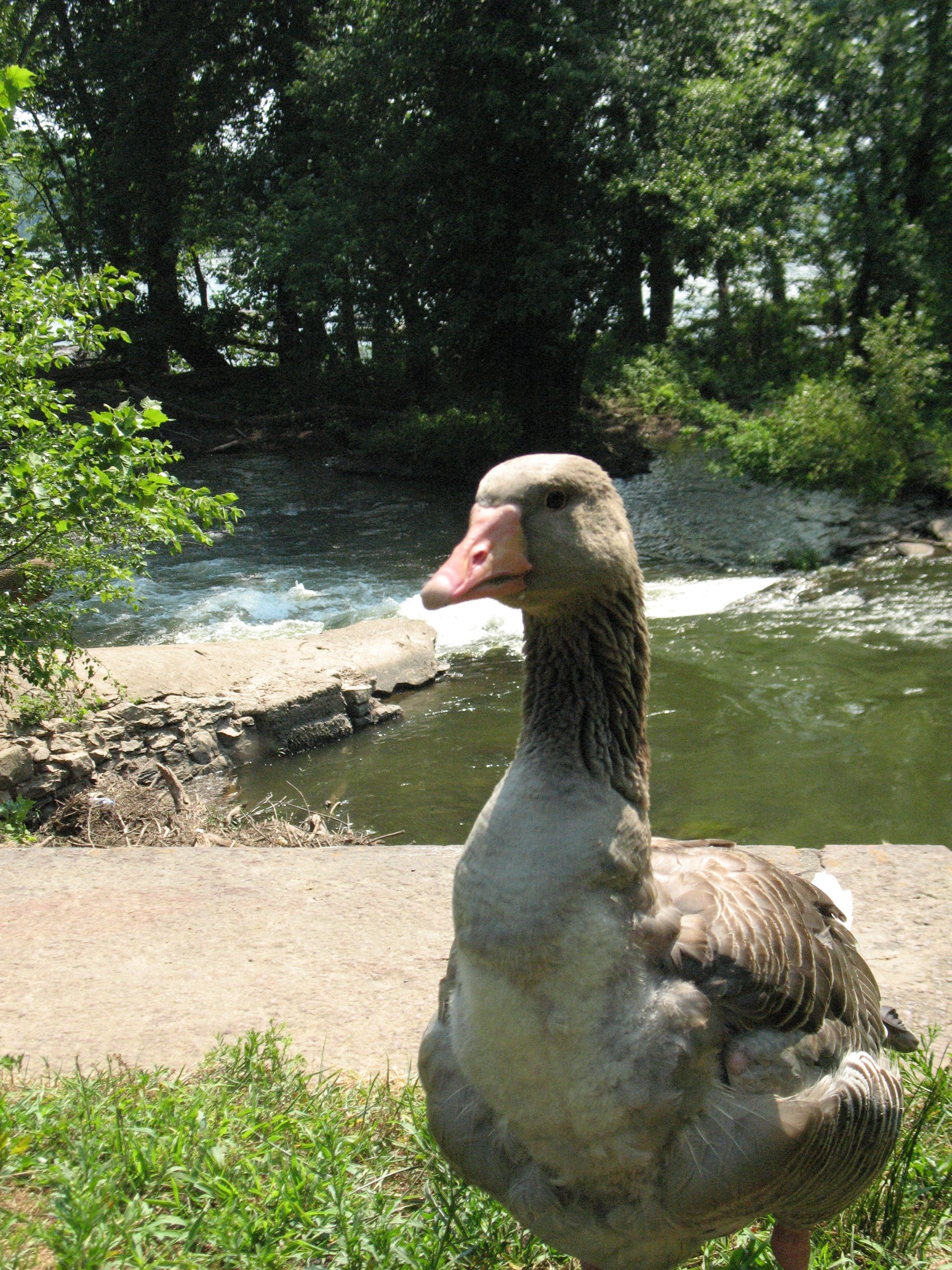
I’ll break the ice by telling a little something about one of my favorite spots. It’s a jewel of a place called Violette’s Lock, a short distance west of the intersection of River and Seneca roads.
Find out what's happening in Potomacwith free, real-time updates from Patch.
It’s a favorite with kayakers, but you don’t need a boat to enjoy the rapids. It’s beloved by birders, but you don’t need binoculars to see the herons, cormorants, and even eagles. It’s a magnet for fishermen, but you don’t need a fishing pole to spot a smallmouth bass leaping up at a newly hatched mayfly.
Just come as you are.
Find out what's happening in Potomacwith free, real-time updates from Patch.
Park in the dirt lot and head to the tow path. The first thing you come to, not surprisingly, is the lock, or rather what looks like two of them. Actually, one of the rock-faced structures channels water from the river into the C&O Canal. The other is the actual lock.
This all comes clearer when you look out across the river. It looks as if someone drew a line from one shore to the other. Upstream, the water is so flat that it could be a lake. But downstream, it gushes and leaps over boulders.
The explanation: This is the site of a dam built to back up the river to send water into the canal intake.
Before strolling downstream, check out the sky for resident bald eagles. If you don’t see any, at least you can be assured of a view of another symbol of our nation: a very large American flag on the Donald Trump National Golf Course on the far shore. Trump erected the flag after he cut down all the trees at the river’s edge to give his golfers a more scenic view.
Continuing on you can hear the rapids, but you still can’t see them. So take a moment to admire the trees closing around you. The small ones with the big, almond-shaped leaves are paw-paws. If they look like the setting for a jungle movie, it’s because nearly all other members of this botanical family live in the tropics. In the fall, when the pungent fruits litter the ground, you’d imagine you’re in a tropical exotic smoothie bar.
Further along you come to concrete wall topped with stones. Choose a place not covered with vines (often poison ivy!) and take a seat. Here you get a great view of the rapids called Seneca Breaks. You might see a fisherman wading out in the river. If it’s midday, he probably won’t be catching much. He wades oh so carefully along the uneven bottom, and then abruptly drops into a deep hole up to his neck.
Examine the canal. It’s bursting with life with scenes out of a children’s nature book. Big, flat turtles line up on logs, herons skulk in the shadows, fish nonchalantly eye passersby. You might even spot a beaver, or a fawn, coming here to drink.
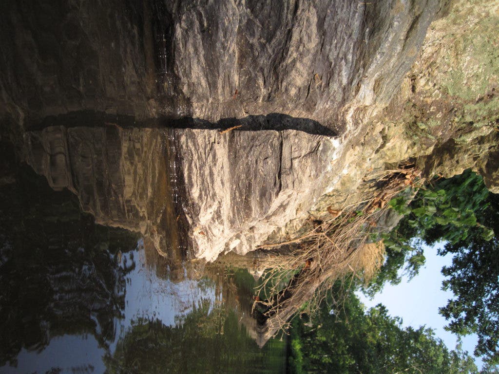
Contrast this with the river. There, the low water of summer reveals a landscape of twisted rock. It is called metagraywacke, a name that only geologists would not find amusing.
The rock was formed deep under the sea hundreds of millions of years ago from sand and silt deposited by massive underwater landslides. When North America collided with Africa and Europe about 300 millions of years ago, these rock layers were convulsed by enormous pressures and lifted to form land.
The rock is still changing. Now the sculptor is the river, particularly when its swift flood waters send down powerful charges of stones and sand. In a contest between rock and water, water always wins.
You get a closer look at these same rocks further along at Blockhouse Point. Delicate plants cling to the sides of the cliffs as in a rock garden. Every so often, you see the remains of holes drilled into the rock by early 19th century construction crews. They stuffed the holes with black powder to blast a path for the canal, sometimes at the cost of eyes and limbs.
But their assault on the river landscape was nothing compared to plans just a couple of decades to run an outer beltway over this very spot. Thankfully, local people rose up to quash the idea. Is the danger gone forever? Certainly not.
After the final cliff you’ll find the 21-mile marker and a path leading down to the river. Take a good look at the water. It is the same water that comes out of our taps. Most likely at this time of year it looks just as clear as anything sold in a plastic bottle.
And really, what bottled water can claim it came from a place with as much history and scenery as the Potomac?

